Every year the readers of the hiking magazine (-> www.wandermagazin.de) vote for “Germany's most beautiful hiking trails”. The result of the 2020 election was published on August 27th - and the Black Forest took first place in both categories!
The Belchensteig won the title in the day tours category, while the Baden-Baden panorama trail received the most votes in the multi-day tours category.
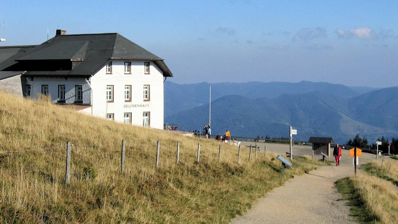
The Belchensteig leads almost 15 km as a circular route through the southern Black Forest and of course to the summit of the Belchen Mountain. This is 1414 meters above sea level. the third highest mountain in the Black Forest, and offers wonderful views in all directions from its treeless summit. The starting point is the Wiedener Eck (municipality of Wieden), but of course you can join the tour at any point. In addition, you can include the Belchenbahn (cable car) in the hike, depending on which direction you go as an aid to ascent or descent.
The Baden-Baden Panoramaweg leads around 45 km around Baden-Baden and into the Black Forest. Here, too, you can include a mountain railway in the tour and take the railway of the same name to Baden-Baden's local mountain, Merkur. The Panoramaweg is a circular route and can be divided into any number of stages. There are several entry and exit points that can be easily reached by car or public transport.
The two excellent hiking trails are undoubtedly highlights - but of course there are many, many more, each with their own charm, varying degrees of difficulty and length. You can find out more about the long-distance hiking trails here at www.black-forest-travel.com in the hiking section.
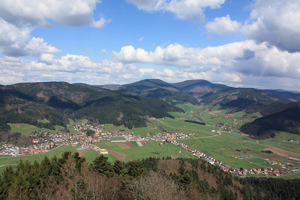
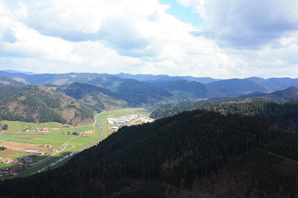
Back in November 2014, the observation tower was opened on the Urenkopf at Haslach , central Black Forest . The days with beautiful views held this winter , however limited, over the Easter weekend, was worth the climb to the tower at 34m height allows of its platform a really nice all-round view of the Kinzig Valley and the central Black Forest .
The tower is accessible only on foot . Next Directions possibility is the trail parking lot at the memorial Vulkan. Shortly after Haslach direction mill creek ( Freiburg), the parking lot is well signposted. Walk from there it is 1 km to the tower , but with a sharp rise . Of course, the tower is also from all other directions within walking distance, or can be integrated into a hike in the area.
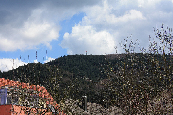
Visible from afar is the new lookout on the Urenkopf
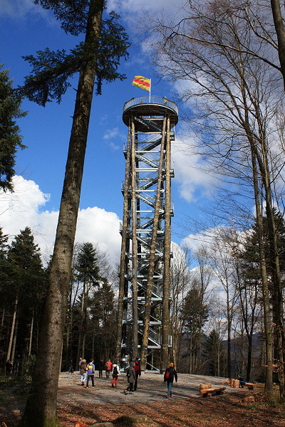
The lookout tower
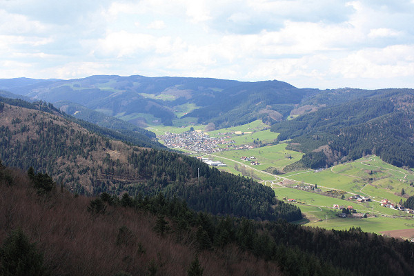
View on Hofstetten
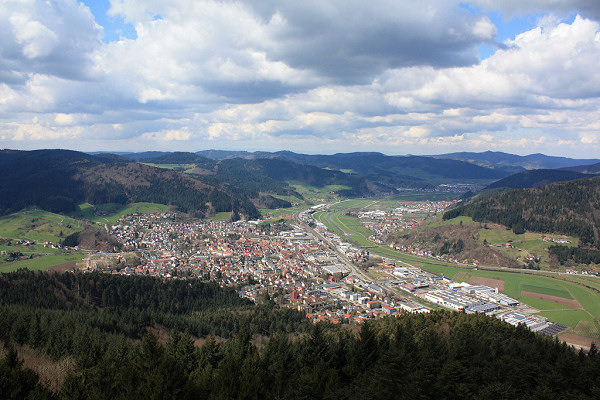
View on Haslach
View on Fischerbach, Brandenkopf Mountain in the background
View direction Hausach
 On www.black-forest-travel.com, in the section "Hiking in th Black Forest" you can find plenty of information about the long-distance hiking trails in the Black Forest.
The most famous hiking trail in the Black Forest ist the West Trail (Westweg). The Westweg leads on 285 km from Pforzheim to Basel. The Westweg can be completed in 12-13 days in sections of 15-25 km. Certainly it can be joined and left anywhere on the route.
The Middle Route (Mittelweg) and the East trail (Ostweg) also lead from north to south through the Black Forest.
The Gorge Trail leads through the most beautiful valleys and gorges in the Southern Black Forest. The Ortenau Wine Trail and the Markgräfler Wine Trail go through the vineyards on the western slopes of the Black Forest.
Hiking is definitely the best option, to discover and enjoy the Black Forest - and, of course, good for health and fitness!
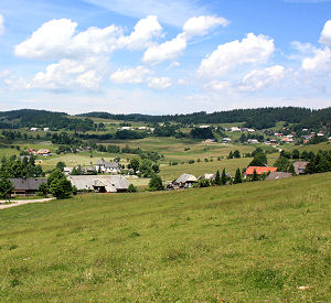
Foto: Magnificent view on Ibach in the Southern Black Forest
 Waterfalls, a narrow canyon, adventurous paths, nature conservation area, a via ferrata and great views can be seen in this hike of about 4-5 hours.
The hike starts in Ottenhöfen (30km south of Baden-Baden) from the parking area for hikers near the Edelfrauengrab Waterfalls (sign-posted). Form here it is only a few steps to the bottom cascade of the waterfalls, where the Edelfrauengrab is located. From there the way is climbing further up the adventurous paths and footbridges along the Gottschläg valley, a nature conservation area.
Further and further you climb up to the Karlsruher Grat at the head of the Gottschläg Valley, there you can use the via ferrata. From there the path leads back to Ottenhöfen from the Bosensteiner Eck at the top end of the via ferrata via the 'Brennte Schrofen', where you can enjoy a great view on the Black Forest and the Rhine valley. The overall distance is approx. 12 km, the difference in height 500m, a walking time of 4-5 hours should be allowed for.
The Gottschläg Valley conservation area with the waterfalls and the Karlsruher Grat (Karlsruhe Ridge) further up is surely an outstanding scenic attraction in the Northern Black Forest.
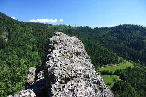
Photo: View from the Karlsruhe Ridge
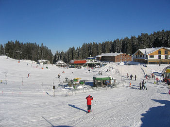
 The Feldberg (1493m above sea level) is the highest mountain in the Black Forest, Germany. The Felderg Mountain is located in the south-west of Germany, about 25 km south-east of the city of Freiburg.
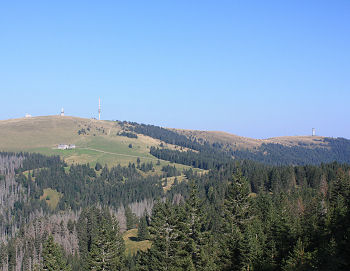
Photo on the right: The Feldberg summit on the left side, on the right side the Seebuck foothill with the lookout tower.
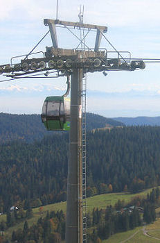
A cableway runs from the car park at the Haus der Natur (House of Nature) to the Seebuck foothill. Incidentally, the cableway is operated as a 6-seater chair lift in winter. The actual summit of the Feldberg is reached from the upper terminus via a 2km footpath. There are several sign-posted hiking trails leading round the summit area with a walking time of between 30 minutes and 3 hours, from which you can enjoy the beauty of the landscape in its entirety and the magnificent views in every imaginable direction.
Ascend the Feldberg Tower and you can let your eyes wander even further into the countryside. However, you have a lovely uninterrupted view even without ascending the tower because there are no trees in the summit area.
The Feldberg is centre of the biggest skiing area in the Black Forest. Usually from November to April thousands of skiers use the 14 ski-lifts and downhills of all categories.
 Places nearby
A wonderful way of getting to know the Black Forest is a hike along the 'Schluchtensteig', a hiking trail in the southern Black Forest. This trail was not opened until 2008 but is already one of the most popular hiking trails in the Black Forest.
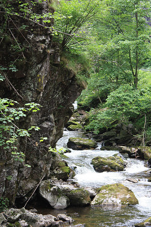
The Schluchtensteig crosses the South Black Forest regional park along the southern edge of the Black Forest. It not only takes in the impressive gorges of the Wutach, Gutach, Rötenbach, Haslach and Wehra (photo) but also regularly ascends to mountain tops and other lookout points which provide a view of the gorges below and the mountains of the High Black Forest and the Swiss Alps. The trail also runs past Lake Schluchsee, the largest lake in the Black Forest. The high plateaus around the villages of Dachsberg and Ibach present an interesting contrast.
The Schluchtensteig is not a footpath, it often runs over narrow trails, over rough and smooth and sometimes up steep tracks and ladders. It is therefore advisable to wear good quality hiking shoes. The hiking trail is passable from May to approx. November. Hiking on the Schluchtensteig is not recommended with snow and ice.
Anyone who wants to hike over the full length of the trail can divide it up into six stages of approximately 20 km each. Needless to say, shorter sections can also be tackled depending on the available time and fitness.
Places along the Schluchtensteig